|
History
Last
updates: New links and new address in Culver City. Who framed Roger
Rabbit? Rails to Trails? Discover the Watts-Bellflower-Santa Ana line!
And join the Red Hot Chilly Peppers and encounter the leftover remnant
from the old Pacific Electric in Downtown LA.
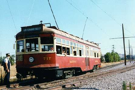
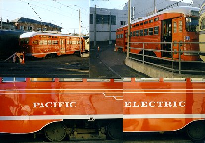
In the beginning of the 20th century Los Angeles hosted a real Light
Rail system. Advanced vehicles, 'the Red Cars', used a network with
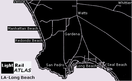
a radius of 35 miles of downtown Los Angeles. The Pacific Electric served
42 incorperated cities and towns, such as San Fernando, Hollywood, Pasadena,
San Bernardino, Orange, and coastal places, like Newport Beach, Long
Beach, San Pedro, and Santa Monica. Pacific Electric’s trolleys
and interurban cars blanketed the Los Angeles area on more than 1000
miles of rail lines.
The
PE-system came to an end when the Los Angeles - Long Beach line closed
in 1961.
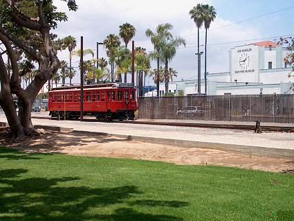
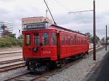
The
harbor of Los Angeles, San Pedro got a PE-heritage service (first trial
runs started in 2002). Historic Pacific Electric 1058 and two 500s replicas
operate a vintage service on a 1,5 mile line, using former PE alignment.
A depot will be built in due time, including an extension (2008). More
information see this
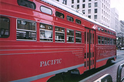
link: "For sixty years, the Los Angeles area was served
by a vast network of electric railway lines operated by the Pacific
Electric Railway. Affectionately known as “Red Cars”, the
Pacific Electric’s trolleys and interurban cars blanketed the Los
Angeles area on more than 1000 miles of rail lines. The last remnant
of the system was abandoned in 1961. Forty-two years later, a small
piece of the system has been resurrected in San Pedro, as the Port of
Los Angeles Waterfront Red Car Line.
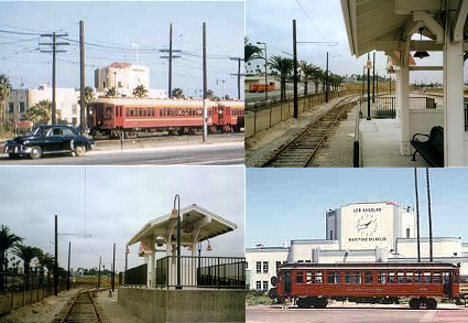
'Blimp'-cars near the Ferry Terminal Building (1957), now the Los Angeles Maritime Museum, and PE 1058 on rubber tyres duties since 1963. Many years later the new 22nd Street/Marina station is already finished (October 5, 2001), waiting to welcome the 1058 again, this time on rails, and the two PE-replica cars 500 and 501, which arrived at the Port of Los Angeles on October 26, 2001. Completion of the cars took place at a Port facility during 2001 and 2002.
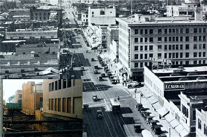
Once PE-cars dominated the business artery of Pasadena. A car on Colorado Street meets a few automobiles, near a point where the Light Rail Goldline nowadays enters Pasadena centre again. A deepened Light Rail section was under construction (October 5, 2001) at right angle to Colorado Street.
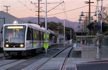
Since June 2003 Pasadena got Light Rail again. The 13.7 mile Gold Line links Union Station in downtown Los Angeles and Sierra Madre Villa in East Pasadena via Chinatown, Highland Park, South Pasadena and Pasadena. The opening of the Gold Line expands Metro Rail to 73.1-miles.
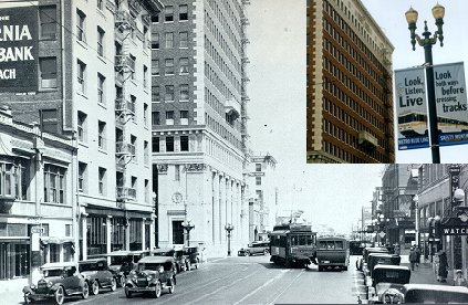
First Street Long Beach during the late 1920's. A PE interurban northbound car turns onto Pine Avenue. Nearly a century later, again First Street, a sign warns: "Look, listen, live. Look both ways before crossing tracks." Light Rail is back in Long Beach. September 2001 is Metro Blue Line's Safety Month.
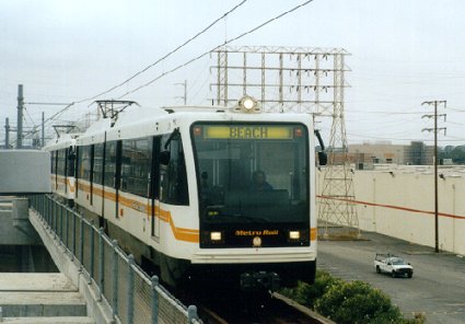
Light
Rail Atlas shot a MTA-car at the Long Beach terminal of the Blue Line,
at First Street and Pine Avenue. The 'Red Cars' left Long Beach in 1961,
but Light Rail Vehicles returned in 1990. The corridor of the former
Long Beach Line has been chosen as the first new Light Rail in Los Angeles.
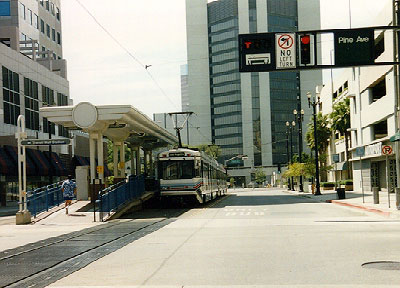
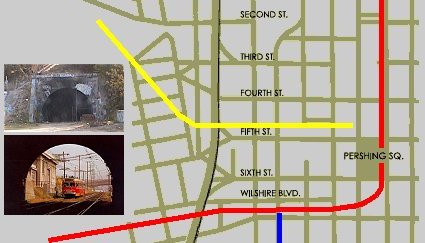
Light
Rail is back in Downtown LA. Metro Red and Blue line reach the central
city by means of tunnels. Still a third tunnel exists. It's a leftover
remnant from the old Pacific Electric. Unfortunately the tunnel has
been sealed off and totally covered by graffiti. The Toluca substation
near the closed tunnel entrance at the corner of Glendale and 2nd suffers
from graffiti too. The downtown section of the tunnel can't be accessed
either as it was filled in when the Bonaventure Hotel was constructed
early seventies. The tunnel served as set for the Red Hot Chilli Peppers'
clip 'Under the Bridge' - "Is the city I live in / The city
of angel / Lonely as I am / Together we cry." (1991)
"A
fast-growing City between Los Angeles and the Sea. Produces more motion
pictures than any city in the world.... Three electric lines and 15
major traffic arteries provide transportations facilities in ALL directions."
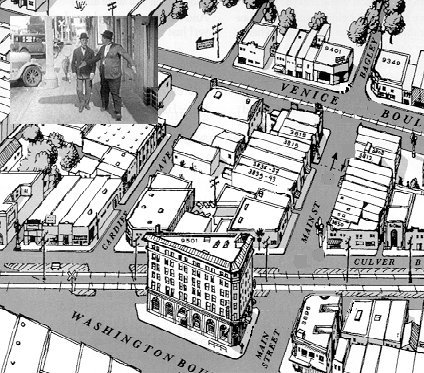
Culver City is named after its developer Harry H. Culver, like Hotel Culver City (block 9501). This hotel was called the 'skyscraper', being the tallest building between downtown Los Angeles and Venice. The cars of the Redondo Beach-Del Ray line followed the tracks of the Venice Short Line to Culver City and passed the hotel at 9.50 mile. Leaving the hotel-block at Washington Boulevard the trip covered a bit more than 14 miles to Redondo Beach and Clifton. Passenger service to Redondo Beach ended in May 1940. Venice Boulevard lost its PE-cars in 1950. Culver City lost its PE-service completely when in October 1953 the last passenger car of the Santa Monica Airline passed Culver Junction.
Venice
Boulevard could be served again by Light Rail if the 'Expositon Line',
from Downtown LA to Santa Monica, will be come reality. The Expo Line
will start in downtown Los Angeles (sharing the existing Blue Line track),
also serving Staples Center and the Convention Center and connecting
to the rest of L.A.'s rail network.
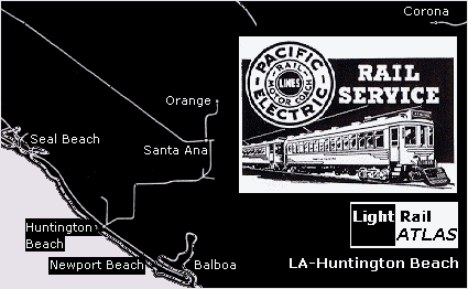
PE's Watts-Bellflower-Santa Ana line covered the southeast of the system.
It has always been a remote service of the PE. Tom Wetzel wrote: "In
the PE era the area beyond Bellflower was still agricultural and in
fact the line had very small ridership - the entire 30-mile line to
Santa Ana handled only about 4,000 weekday boardings in the late '40s.
The line's revenue barely paid half its operating costs - despite the
fact that the operating costs were artificially depressed by a practice
of deferred maintenance (most of the rail was the original track when
the line was built). The area that it runs through since WWII was built
into a vast low-density auto-oriented sprawl. There are few concentrated
destinations along the line (Cypress College is one of the few I can
think of)."
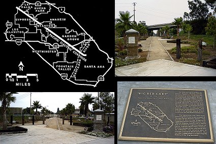
Nowadays
a plaque commemorates the Santa Ana Line. A map represents the local
"Pacific Electric Corridor". Parts of this corridor
can still be visited.
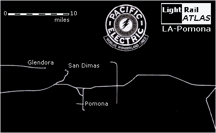
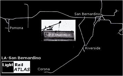
The PE was once the world’s largest 'Light Rail' system, extending
from Los Angeles to its outlying regions, to San Bernardino and villages
like Pomona, Claremont, Fontana and Rialto. The building of the railway
through the Inland Empire was crucial to the development of the area,
particularly to support the agricultural industry that fueled the local
economy.
Reyner Banham (1971) gave the following description of the PE-system: "The Big Red Cars ran all over the Los Angeles area - literrally all over. The route map of the PE at its point of greatest extensions, when it operated 1.164 miles of track in fifty-odd communities pretty well defines Greater Los Angeles as it is today. Services ran down the coast to Balboa and along the foot of the Palisades to the mouth of Santa Monica Canyon; up into the valley and to San Fernando; to Riverside, Corona, and San Bernardino; out through La Habra and through Anaheim to Orange; through the foothill cities of the Sierra Madre to Glendora, and via Pasadena to Echo Canyon and Mount Lowe. Within the area laced by this network the stops and terminals already bore the names of streets and localities that are current today."
In San Francisco a PCC on the F line is disguised as a PE-car: in the famous red and gold butterfly wings livery. PE used (not this kind of !!) PCC cars on the Glendale and Burbank branches of the system. In 2005 local citizens took an initiative to bring back streetcars in Glendale.
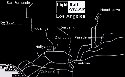
Today
MTA's Blue Line (1990) covers the last PE line (closed in 1961) between
Downtown LA and Long Beach. The Green Line (1995) serves a new corridor,
but the third Ligt Rail line, the Gold Line, northern Blue Line-branche,
runs to old 'PE'-place Pasadena.
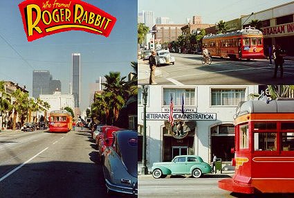
Some shots were made on Hope Street in LA between 11th and 12th St. about a block from the Blue Line subway portal. The cameras always aiming south to avoid getting the skyscrapers in the movie! The lip on the car provided a place for the cartoon Roger Rabbitt to stand. Who Framed Roger Rabbit (1988) is a technically-marvelous film which combines live action and animation. A cartoon rabbit (Roger) lives in LA (Hollywood/'Toontown') during the late 1940's, when PE's 'Red Cars' ran throughout the Los Angeles conurbation. In one of the scenes character Valiant tries to board a PE-car bound for Sunset Boulevard, but is denied entry by the conductor (James O'Connell) when all he can come up with is his paper check. He joins a group of young boys already hitching a free ride on the back of the Red Car. Valiant's comment to one of the boys: "Who needs a car in LA? We got the best public transportation system in the world." In reality all PE-lines were replaced with buses. In the film however the Redcars and Toontown survive, because in Hollywood's movies good triumphs over evil.
Back to top of this page.
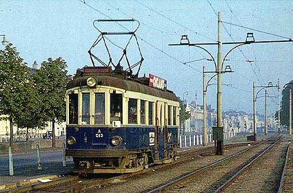
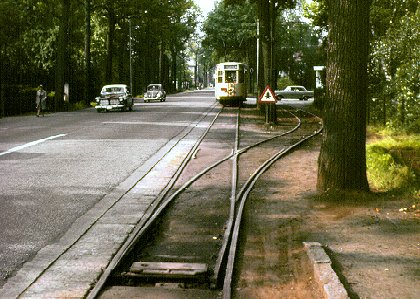
In
The Netherlands all interurban systems were closed. The last one run
until 1961 and nearly all of its famous blue cars were destroyed (the
last non-electric was closed in 1968). Only one line survived. This
was the The Hague-Delft route. Eventually the elegant yellow cars of
this interurban were replaced by PCC's (1965). Several years ago the
system expanded to the coast as well as to new residential areas.
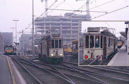
Another European example: Belgium. Once upon a time interurbans served a nation wide system. Only small parts in Wallonia and the large coastal line survived. Back to Europe section. Back to top of this page.
|
|
Europe
|


|
Reyner Banham (1971) gave the following description of the PE-system: "The Big Red Cars ran all over the Los Angeles area - literrally all over. The route map of the PE at its point of greatest extensions, when it operated 1.164 miles of track in fifty-odd communities pretty well defines Greater Los Angeles as it is today. Services ran down the coast to Balboa and along the foot of the Palisades to the mouth of Santa Monica Canyon; up into the valley and to San Fernando; to Riverside, Corona, and San Bernardino; out through La Habra and through Anaheim to Orange; through the foothill cities of the Sierra Madre to Glendora, and via Pasadena to Echo Canyon and Mount Lowe. Within the area laced by this network the stops and terminals already bore the names of streets and localities that are current today." Back
to top of this page. |