Highlights
Breakthrough
light rail in Belgium
The
regional international tramway Hasselt (Belgium) – Maastricht
(Netherlands) has been approved by the Flemish government (October
2013). Meanwhile extensions of the networks of Antwerp and Ghent
are in full progress.
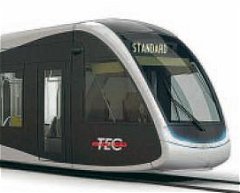
Design
for new tram of TEC, Liège.
In
Wallonia in Charleroi, after years of decline, the tramway
network has been extended along former and planned alignments.
The city of Liège prepares a French style urban system.
Breakthrough
light rail in Denmark
Danish
light
rail projects are in progress. In Aarhus (second city of Denmark)
construction of the regional tram-train project is in preparation.
The ‘Ring 3’ project, a tangential tramway in the urban
region of Copenhagen is approved and in preparation. Other projects
among others: a French-style urban tramway in the city of Odense.
More
information
at our friends of www.letbaner.dk/…
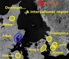
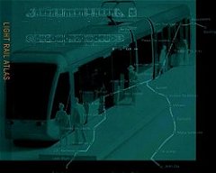
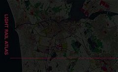
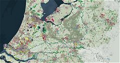
Light
rail map (LRA, 2013)
Also
light rail in neighbouring regions in Sweden: Goteborg (existing
tram system) and serious plans in Malmö, Lund and Helsingborg.
Drawback
light rail Netherlands
Unfortunately
the ambitious RegioTram project in Groningen has been
killed late 2012, mainly due to politicized considerations
and miss-interpretations.
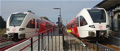
The
region of Groningen are and will be served by regional trains,
like these ones at the station of Winschoten.
The
light rail scheme Zwolle-Kampen is converted into a heavy rail
solution, using regional trains.
Dutch
RijnGouwelijn killed

No
highlight. But a very bad 2011 for the RGL project, one of the
biggest light rail schemes in The Netherlands. After years of
political battle new elected officials pulled the plug. RGL: 'rest
in peace'.
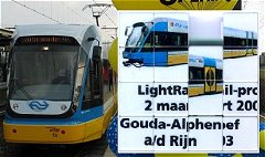
Despite many years of preparation neither politicians nor professionals
could solve the project puzzle.
New
tramway in Tokyo
Tokyo city budget for 2011 includes funding for
the construction of a new tramway, running from Ginza to the Harumi
area of Chuo Ward. More info: at Japan
Probe...

Groningen
(Netherlands) decided to introduce a tram. The proposed system
entails two lines (2016) and regional 'tram-train' extensions
(after 2020).
The official web site: www.regiotram.nl/.
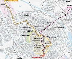
Groningen
city: urban map
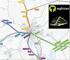
Groningen
region: regional map
More
highlights
here...
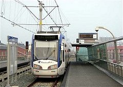
RandstadRail
is another important light rail project in The Netherlands. Since
2011 fully operational.
Zwolle-Kampen
After
RandstadRail a new TramTrain in The Netherlands: according to
the awarded proposal of Rob van der Bijl (LRA) et al. - and already
announced at the pages of LRA several years ago (2003).
The regional 13km railway in the province of Overijssel between
Zwolle and Kampen will be transformed into tramway. 2015 this
'conversion type' project is due to open. The tram is justified
by the fact that it offers better accessibility to existing and
new urban areas. Five new stops have been envisaged.
More
highlights
here...
|