FEATURING...
by Rob van der Bijl
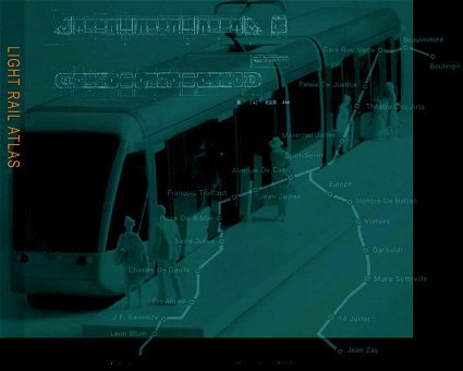
the old background of Light Rail Atlas, December 2006The old background, designed by Lex Koetzier in 1998, has been replaced by a new version in December 2006. This new version is based on a map of the western part of The Netherlands (NIROV, November 2005) representing the future urban developments and related infrastructure. This new background suits to illustrate the emphases of Light Rail Atlas on the interrelation between light rail and urban planning. Nevertheless we don't want to forget the old background.
The sober, dark-green background of 1998 reflects the meaning of light rail developments at that time in France. Two French projects are depicted. The first one is the tram project of Rouen, opened in 1994. The map of this network is clearly visible. The terminus Boulingri at the north side of the central city is used by the system's two lines which share an alignment through the city centre, party in tunnel, to the stop Saint-Sever. From here each line continues to respectively the terminus of Leon Blum and Jean Zay. The model of a tram, serving a platform and its passengers belongs also to the project of Rouen.
Plan and elevation at the top of the picture show the well-known 'Eurotram' of Strasbourg. The tram of Strasbourg is really famous and like Rouen opened in 1994.
Mail LRA your questions and comments.